
U.S. Maps & Geography- The Ultimate Label & Color Maps Pack! (American History)


- PDF
What educators are saying
Also included in
 Throw your back out? Need a mental health day (or days)? New to teaching US History? Or, simply... do you want to shift away from constant teacher-led instruction? Then this 400+ page bundle is a MUST for your classroom! Many of these resources will supplement US History units that you teach thPrice $21.95Original Price $37.49Save $15.54
 Be ready for the school year with this massive bundle of US History resources, AND SAVE LOTS OF $$. My smaller "Make Life Easy" Bundles were created to give Social Studies teachers a hand when it comes to lesson planning and instructional preparation. This "Big Bundle" combines all of those resourPrice $59.95Original Price $95.68Save $35.73
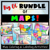 Humans love coloring- tap into your students' interests and apply it to your Social Studies and Geography lessons! 21 different map activities are available and cross many different social studies topics- like American History or Ancient Civilizations. All maps are completely student-centered andPrice $27.99Original Price $37.89Save $9.90
Description
This United States Ultimate Maps & Geography Pack includes eight different maps for your American History student explorers- Political Map, Physical Map, Native American Cultural Regions, 13 Colonies, Westward Expansion, 5 Regions, Civil War, and a World Map. These labeling and coloring activities are interactive, engaging, and ready to use- just print and copy! A Teacher’s Guide is provided, as well as options for use to fit your curriculum/lesson. You will also receive a completed, colored version of each map, along with fun ways to assess their learning.
As a student-centered resource, these maps are great to include in your emergency substitute folder, easy to assign during independent learning centers, and a fantastic supplement your lessons on American/ United States history! **While this resource has been made Google and Easel compatible, the blank maps are intended to be printed for coloring and labeling purposes.
This resource can be used with many different student ages and ability levels.
Oh- and you save $$ with this maps pack. You save over $5.00 as opposed to purchasing each map separately!
Map Topics Included:
- Political Map: identify the 50 states
- Physical Map: Land forms and features
- The Five Regions: Northeast, Southeast, Mid-West, Southwest, West
- Native American Cultural Regions
- A Bonus World Map- find the US on the World Map!
Also included:
- Map Directions with suggested colors to use for each map
- “Fast Facts” section to complete (Online sources or a textbook is needed for this)
- Individual “I Can” self-assessments or Analysis Follow-Up questions for each map
- “I Live Here!” option for students to locate themselves on the maps
- A wholistic activity option to compare, analyze, and assess the maps collectively.
- A fully colored and completed example of each map to use as reference
- A Teacher Guide
- A link to the Google Compatible resource (best used for directions and follow-up questions; blank maps are intended to be printed)
Why stop here?! Get MORE student-centered map activities (including this Ultimate Maps Pack) with the BIG OL' BUNDLE OF MAPS ACTIVITIES Resource!
Want to add a state map activity? Texas, Florida, California, New York, Washington, Iowa and Virginia are available to purchase!
Looking for Maps of the World? I've got you covered!
**Please give feedback (and you will earn TpT $$!), and ‘Follow Me’ so that you are the first to get updates and new products!
