103 results
Preschool geography interactive whiteboards
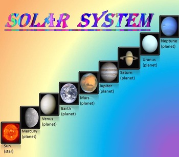
Solar System | Planets | PowerPoint | The Sun | The Moon | Distance Learning
Solar System | Space Quiz | Earth's orbit | Planet ActivitiesThe zip file contains:Solar System - Interactive slide show- inner planets: Mercury, Venus, Earth, and Mars; - outer planets: Jupiter, Saturn, Uranus, Neptune;- Earth's orbit- The Sun- The Moon - Space Quiz- AnswersThis is a beautiful and informative 30 slide PowerPoint presentation and 22 pages PDF.I've given you 4 slides to look at in the Download Preview – take a look! AstronomyPlease note that this package is also part of the bu
Subjects:
Grades:
PreK - 8th
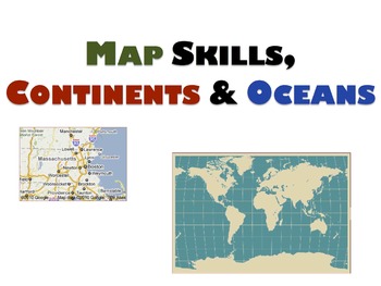
Geography Unit & Student Workbooks - Grades 1 & 2
This is a huge unit with 5 presentations and 3 student worksheets.
The unit covers:
Map skills:
- What is a map?
- Cardinal directions(north, south, east, west)
- Equator, north pole, south pole
Continents:
- 7 continents
- size order
- land
- animals
- facts
- location
Oceans
- 5 oceans
- names
- locations
The 3 student workbooks include activities for all topics above such as:
- fill-ins
- cut and paste names onto maps
- writing and identifying names of continents and oceans
-
Grades:
PreK - 2nd

Bear Powerpoint! Black, Brown, Grizzly, Polar, Sun, Panda, Koala
I created this PowerPoint to help my students learn about different types of bears. It focuses on each different type of bear (and Koala's) and teaches facts that allow students to compare and contrast the different types of bears (and marsupials)! Students will learn where each of these bears live, what they eat, hibernation techniques, cubs (and joeys), size, and fun facts! There are multiple links for short informational videos about each type of bear that correlate to the material being read
Subjects:
Grades:
PreK - 5th
United States Social Studies Kindergarten or First Grade PowerPoint Game
United States Social Studies Kindergarten or First Grade PowerPoint Game: Learn about the United States and celebrate the 4th of July with the United States Trivia Game. This interactive PowerPoint game is a great introduction activity to learn about the United States. The game is appropriate for kindergarten or first grade classrooms. In teams, students have to find the correct answers to trivia questions. If they get a correct answer they get stars on their flag. The first team to get 50 stars
Grades:
PreK - 2nd
Landforms Vocabulary Powerpoint
A simple powerpoint to introduce young or ESL students to landform vocaulary. Covers mountai, island, valley, ocean, river, and hill.
Subjects:
Grades:
PreK - 2nd
Texas Symbols & Jose Antonio Navarro, Houston, Austin - SMARTboard
It's Texas Y'all - SMARTboard Learning Made FUN!!!
Everything you need to teach your kids about Texas on the Smartboard!
This in depth 35 page package includes a variety of slides to suit your students' ability levels. With both highly educational AND fun activities included, you will have everything you need to complete your Texas unit - and best of all - you get to just store the file on your computer for next year rather than trying to keep up with all of the paperwork!
CHECK OUT THE PREVIE
Grades:
PreK - 5th
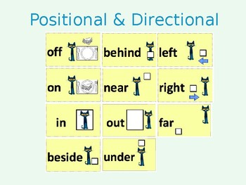
Positional and Directional Words Lesson Materials/Activities
Throughout the learning segment, students will build upon their understanding of geographic terms and representations using the themes of geography (e.g., location, place, human-environment) to describe and identify their surroundings. Moreover, the lessons will focus on positional and directional words including the following terms: in, on, out, under, off, beside, behind, near, far, left, and right.
This product includes:
Positional and directional words cards
Kid-friendly videos
Interacti
Subjects:
Grades:
PreK - 1st
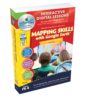
Mapping Skills with Google Earth™ BIG BOX - PC Gr. PK-8
**THIS is a PC Version**This PC Flash version (compatible with any brand of IWB) is to be used on a PC platform and can be used on a computer, IWB or PC tablet.**PLEASE NOTE: This resource requires FLASH to be installed on your device.Click Here To View Product DemoExplore the concepts of mapping skills with your students with our engaging and highly interactive 240 screen-page digital lesson plan for grades prekindergarten to eight. About this Resource: Combining the 3 digital lessons in this s
Grades:
PreK - 8th
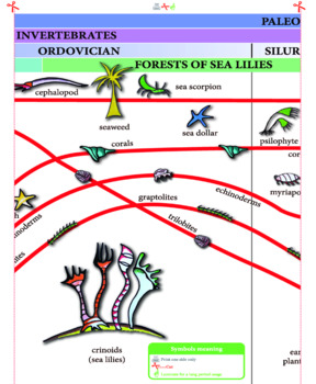
Timeline of Life - 1,3 meters long
This timeline is a very valuable resource to use at home, to study geological eras and the evolution of species. Children can analyze evolutionary patterns, from the Cambrian Period to modern times. Each line is clearly marked and contains beautifully illustrated images. Also highlighted are the significant events in the evolutionary history of the planet: the disappearance of trilobites, glacial periods, the appearance of dinosaurs. This information allows children to understand the events that
Subjects:
Grades:
PreK - 2nd
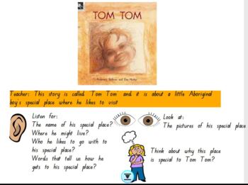
HASS Prep 'Tom Tom' by Rosemary Sullivan and Dee Huxley
This is a FlipChart for Interactive Whiteboards.This is based on the book Tom Tom for Prep HASS (My Special Place). This is a great task for online learning and also to engage the whole class. There are numerous interactive activities to help the student's engage with the task. It also introduces the concept 'bird's eye view' by using a kookaburra flying over Tom Tom's town. The students have to label the map and also engage with the story about Tom's special place and their own special places.
Grades:
PreK - 2nd
April is Arab-American History Month!
Celebrate the achievements of history-making Arab-Americans with daily biographical profiles, videos and reading passages. This presentation is perfect for enhancing diversity and inclusion lessons, for morning meetings, daily lesson openers, entrance / exit tickets, and project introductions.
Subjects:
Grades:
PreK - 12th
Talking About Geography!: SMARTBOARD Activities
If you want to supplement your study of GEOGRAPHY, this is the resource for you! This file is complete with TWELVE different social studies activities that can be used in your classroom for whole group instruction, small group work, or individual practice! This SMART Board file includes the following:Geography VocabularyKWL ChartLabelsMap KeyContinentsGlobesMapsCardinal DirectionsVenn DiagramSortingBuilding Your Own MapLand and WaterThis file was created using SMART Board 15 and is supported by
Subjects:
Grades:
PreK - 1st
Mapping Skills with Google Earth™: Map Your Classroom - Activity - PC Gr. PK-2
**THIS is a PC Version**
This is a Interactive Mini. It is just one activity from the full lesson plan Mapping Skills with Google Earth™ - PC Gr. PK-2.
About this Resource:
In this Map Your Classroom mini, students will learn how to map a small area, such as their classroom. Students drag things that appear in a classroom to the map of a classroom. Follow the prompts for a complete score, or create your own..
Our content meets your State Standards and are written to Bloom's Taxonomy.
****
Subjects:
Grades:
PreK - 2nd
Types:
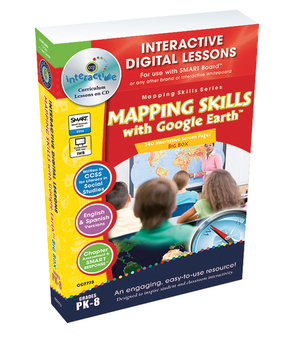
Mapping Skills with Google Earth™ BIG BOX - MAC Gr. PK-8
**THIS is a MAC Version that will ONLY work on MAC OS 10.9.5 Mavericks or earlier.**This MAC Flash version (compatible with any brand of IWB) is to be used on a MAC platform and can be used on a computer or IWB.**PLEASE NOTE: This resource requires FLASH to be installed on your device.Click Here To View Product DemoExplore the concepts of mapping skills with your students with our engaging and highly interactive 240 screen-page digital lesson plan for grades prekindergarten to eight. About this
Grades:
PreK - 8th
Mapping Skills with Google Earth™: How to Read a Map - PC Gr. PK-2
**THIS is a PC Version**
View this video by copying this link and pasting it into a web browser: https://www.youtube.com/watch?v=jY4CXurcx7k
For understanding How to Read a Map of Mapping Skills with Google Earth™, this chapter mini provides curriculum-based content in the form of reading passages, before you read and after you read questions. Also included are printables, vocabulary flash cards, video, audio and interactive activities. Our content meets the Common Core State Standards and are
Subjects:
Grades:
PreK - 2nd
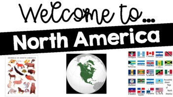
WELCOME TO...North America
A fun and education PPT on North America. Fact, pictures of geography, animals, food, and places to see are included. I also typically visit the "places to see" using Google Maps street view to have a virtual experience with my students. Use my other resource - "Postcards from..." to have your students write about what they learned.
Grades:
PreK - 3rd
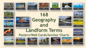
168 Geography and Landform Terms PowerPoint Slideshow
This PowerPoint slideshow aligns with most state standards and Classical Conversations Challenge A program. Additionally, these cards include terms specifically related to Hawaii's geography features such as windward, lava tube, etc. (Please see list below for a full list of terms.)Many terms have similar definitions and can be used interchangeably with one another; therefore, each term in this packet has different a different photo. This packet contains 168 geography terms. These terms are as
Subjects:
Grades:
PreK - 12th, Staff
Also included in: Geography Terms Classical Conversations Aligned Bundle
Mapping Skills with Google Earth™ - PC Gr. PK-2
**THIS is a PC Version**This PC Flash version (compatible with any brand of IWB) is to be used on a PC platform and can be used on a computer, IWB or PC tablet.**PLEASE NOTE: This resource requires FLASH to be installed on your device.Click Here To View Product DemoTeach your students the basics of map reading with our engaging and highly interactive 80 screen-page digital lesson plan for students in grades prekindergarten to two.About this Resource: Start with the elements found on a map, such
Grades:
PreK - 2nd
Mapping Skills with Google Earth™ - MAC Gr. PK-2
**THIS is a MAC Version that will ONLY work on MAC OS 10.9.5 Mavericks or earlier.**This MAC Flash version (compatible with any brand of IWB) is to be used on a MAC platform and can be used on a computer or IWB.**PLEASE NOTE: This resource requires FLASH to be installed on your device.Click Here To View Product DemoTeach your students the basics of map reading with our engaging and highly interactive 80 screen-page digital lesson plan for students in grades prekindergarten to two.About this Reso
Grades:
PreK - 2nd
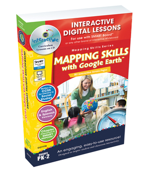
Mapping Skills with Google Earth™ - NOTEBOOK Gr. PK-2
**THIS is a SMART Notebook Version**You will need SMART Notebook software to open this resource.**PLEASE NOTE: This resource requires FLASH to be installed on your device.Click Here To View Product DemoTeach your students the basics of map reading with our engaging and highly interactive 80 screen-page digital lesson plan for students in grades prekindergarten to two.About this Resource: Start with the elements found on a map, such as symbols, legends and the compass rose. Then, have your studen
Grades:
PreK - 2nd
iSpy Interactive Reveal-a-Picture PowerPoint: Kindergarten Social Studies
Engage your students, ignite their curiosity, and inspire meaningful discussions about core Social Studies concepts! This product contains 42 reveal-a-picture PowerPoint slides correlated to Kindergarten Social Studies standards (and to the TEKS for those in Texas). These hidden images are the perfect way to kick-start new units of study.
Download the preview for a much more detailed explanation of how to use this product and for a sample reveal-a-picture slide!
PLEASE NOTE: This product is
Grades:
PreK - 2nd
Mapping Skills with Google Earth™: How to Read a Map - NOTEBOOK Gr. PK-2
**THIS is a SMART Notebook Version**
View this video by copying this link and pasting it into a web browser: https://www.youtube.com/watch?v=jY4CXurcx7k
For understanding How to Read a Map of Mapping Skills with Google Earth™, this chapter mini provides curriculum-based content in the form of reading passages, before you read and after you read questions. Also included are printables, vocabulary flash cards, video, audio and interactive activities. Our content meets the Common Core State Standa
Subjects:
Grades:
PreK - 2nd
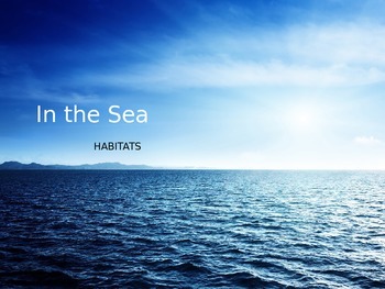
Ocean Habitat PowerPoint
This is 12 slide PowerPoint with images of the ocean / sea habitat with an emphasis on learning the letter "S". It includes pictures of sharks, seahorses, starfish, stingrays, sand, and more. This is a great introduction to a unit on Oceans or Habitats.
Grades:
PreK - 2nd
Landforms
This lesson allows students to be engaged and hands-on the entire time. Using the SmartBoard students will see real landforms, and are able to click to reveal the description of each landform. It challenges the students enough to wear they are actively engaged the entire time. After going over the landforms, the students are able to use play-dough to create their own landforms.
Subjects:
Grades:
PreK - 2nd
Showing 1-24 of 103 results


