19,459 results
Geography resources for Microsoft Word and for early intervention
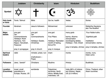
Compare World Religions Chart --Judaism, Christianity, Islam, Hinduism, Buddhism
This is a chart I use with my students to compare five major world religions-- Judaism, Christianity, Islam, Hinduism and Buddhism. It is meant to have the students learn the basics and be able to know the major aspects of all the religions. I included a blank copy and a completed version. In my social studies textbooks, there is quite a bit of info about each of these religions. This can also be done this as a group jigsaw activity. Feel free to edit it to suits your needs. Let me know if
Subjects:
Grades:
5th - 10th
1 Year Old Curriculum For Babies and Toddlers: ENTIRE YEAR BUNDLE
This YEAR-LONG curriculum plan includes everything you need to run an in-home daycare or school-based childcare center program for children one-year old/ 12-24 months old. Designed to be developmentally appropriate for one-year-old children, this 1 Year Old curriculum resource includes teacher guides that provide information on attachment theory and typical development, explicit how-to-use instructions for the program, detailed lesson plans, multiple planning page templates, daily schedules, mon
Subjects:
Grades:
Staff
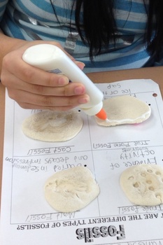
Types of Fossils Activity
Different types of fossils. True form, cast, mold, and trace fossils. Students will replicate each type of fossil and glue it to the handout.
Subjects:
Grades:
1st - 10th
Types:
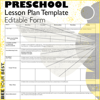
Preschool Lesson Plan Template - EDITABLE FORM
This Preschool Lesson Plan weekly template is completely EDITABLE in Microsoft Word. This week at a glance EDITABLE preschool lesson plan form is created in landscape orientation. Create and organize plans for early childhood programs, preschool, preschool special education, prekindergarten and KIndergarten classrooms. This EDITABLE Preschool Lesson Plan template includes 3 pages with your Daily ScheduleLearning Stations, as well as identify your focus centersLearning Standards or “I can” statem
Subjects:
Grades:
PreK - K, Staff
Types:
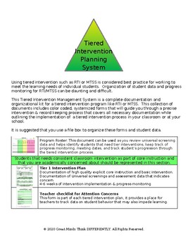
Tiered Intervention Plan Management (complete documentation system) MTSS RTI
Entire RTI MTSS Documentation System• Simple classroom based implementation system. Outlines a complete tiered intervention process for RTI/MTSS or your classroom/school program! • Works with any universal screening tools, intervention methods, or progress monitoring assessments you already have in place! • Keep all documentation organized! • Quickly access all Intervention information on any student! • Classroom teachers save time on documentation and paperwork allowing for more individualized
Grades:
Not Grade Specific
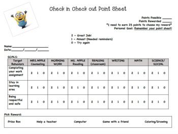
Editable Check In Check Out Point Sheet
This point sheet is a wonderful tool for school counselors, special education teachers, or school social workers. The Check In Check Out (CICO) program is a Tier 2 behavior intervention that has worked wonders with a population of struggling students.
Grades:
Not Grade Specific
Types:
Central America and the Caribbean Mapping Activity
This product is a mapping activity on the region of Central America and the Caribbean. Students will label and color 26 different countries and territories as well as draw and label major physical features. When students have completed the map they will then answer 10 questions based on their map.This product also contains a blackline political maps of the region. I typically make the map a 11x17 making it easier for students to label countries and physical features.This is a rigorous map projec
Grades:
6th - 12th
Types:
Also included in: Geography Mapping Activities BUNDLE
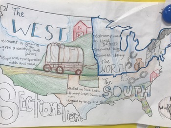
Sectionalism Mapping Activity
Students will identify the three distinct regions in the United States during the mid and early 1800s. They will identify and categorize the traits of each, separating them into regions. Next, they will label, color, and illustrate the regions based on these same characteristics.
Subjects:
Grades:
6th - 9th
Types:
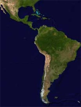
Latin America Mapping Activity
This product is a mapping activity on the region of Latin America. Students will label and color 24 different Latin American Nations as well as draw and label major physical features. When students have completed the map they will then answer 9 questions based on their map.This product also contains a blackline political map of Latin America. I typically make the map a 11x17 making it easier for students to label countries and physical features.This is a rigorous map project that makes the stude
Grades:
6th - 12th
Types:
Also included in: Geography Mapping Activities BUNDLE
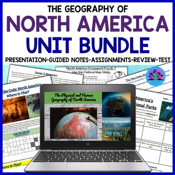
Geography of North America: United States and Canada Unit Bundle
This bundle covers the physical and human geography of North America, focusing on the United States and Canada. The resource includes many worksheets and activities that can be completed digitally or on paper, a Google Slides presentation, guided notes, an instructor's copy of the guided notes, a review sheet, and a test. This resource will help your students learn about the geography of the United States and Canada, from history and geography to culture, economy, and current issues.★☆★Here is a
Subjects:
Grades:
7th - 10th
Types:
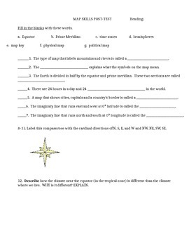
Map skills quiz includes continents, oceans, scale, time zones, latitude & more
This is a social studies assessment for basic map skills for late elementary and middle school students. Skills included are:Map skills vocabulary: equator, prime meridian, times zones, hemisphere, physical map, political map, map keyLabel compass rose and latitude and longitude lines. Matching continents and oceans. Interpret maps-- latitude and longitude, time zones, and grid map. It could also be used as a group activity rather than a test. Feel free to adapt it to your own needs. Answer
Subjects:
Grades:
4th - 9th
Types:
Teacher Friendly RTI Documentation (Editable Form)
The editable Teacher Friendly RTI Documentation Form provides you with everything you need to keep detailed notes about your struggling students. Because the form is editable, new information can be added each month to provide a thorough picture of the student’s strengths and weaknesses at a glance. This form contains space to record student demographic information, special services received, important grades, testing information, and interventions that have been implemented. A sample completed
Grades:
K - 5th
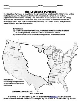
Louisiana Purchase and Lewis and Clark Handout
This is a complete packet on the Louisiana Purchase, and the Lewis and Clark expedition, with attached question worksheet. Students color in a map of the Louisiana Purchase, read background information, and answer questions relating to it. Students also read about the Lewis and Clark expedition, and answer questions for that as well.
Grades:
6th - 12th
Types:
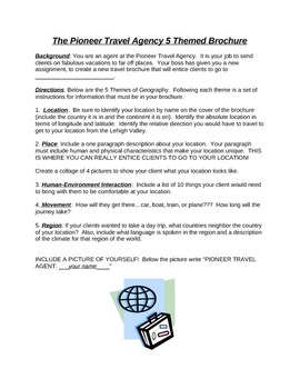
Travel Agency Brochure Project worksheet - 5 Themes of Geography
Students create a travel brochure for an assigned or chosen country using the 5 themes of geography to generate content for their brochure.
Rubric included.
Grades:
5th - 8th
Types:
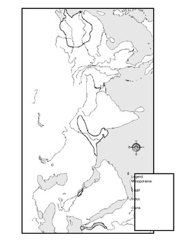
Ancient River Valley Civilizations Mapping Activity Worksheet
This mapping activity is on the Ancient River Valley Civilizations. Ancient River Valley Civilizations Mapping Activity includes explicit instructions on how to complete the map as well as questions based on the map along with knowledge based questions Ancient River Valley Civilizations.Students will label and color different aspects of Ancient River Valley Civilizations such as; cities, seas, important physical features and shade the area for each of the four main River Civilizations. This map
Subjects:
Grades:
6th - 12th
Types:
Also included in: Historical Mapping Activities BUNDLE
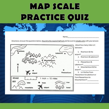
Map Scale Practice Quiz
Check out my other $1 sale here: Latitude and Longitude BattleshipI use this simple quiz as an introduction to using map scale. It can be used as a pre-assessment, post-assessment, or as an instructional tool. The quiz can be used in many different grade levels depending on how much practice your students have had with using scale. We do these five simple questions together as a class, and then I give them an additional scale worksheet that students complete on their own. This particular file is
Grades:
4th - 7th
Types:
Also included in: Map Scale Bundle
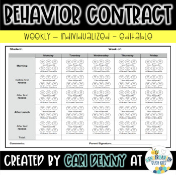
Weekly Behavior Chart Editable
This is an editable weekly behavior chart. It is individualized to meet your students needs while reinforcing positive behavior. You can edit and modify the desired behaviors and daily schedule for your classroom and your specific student. This behavior chart measures two behaviors throughout the day so the student is able to focus on specific behaviors and self-reflect throughout the day. This chart provides visual reinforcement of the desired behaviors that students can relate to (sad face, st
Grades:
PreK - 6th
Types:
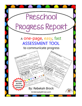
Preschool Progress Report: One Page FAST and EASY Communication Tool
Looking for a QUICK and EASY way to assess your preschoolers' progress? The 'Preschool Progress Report: One Page FAST and EASY Communication Tool' is just what you need! This product includes the actual assessments (and the resources to administer them) you need for a successful, quick assessment. Parents will be able to see at a glance their child's current status...and will be able to see growth as future Progress Reports come home!
All materials are aimed at evaluating for (and helping s
Grades:
PreK - K
Globalization
The assignment contains 34 questions about the positive and negative effects of globalization. Students will watch a 7-minute video clip and use an internet article to answer the questions. I have included an answer key. Please message me if you have any questions. ⭐Engaging!⭐No prep lesson!⭐Editable Word Document⭐The assignment does not require the use of a textbook.*The document can be uploaded to your website or Google Drive; please make sure, however, that it is password protected.Topics/Key
Grades:
6th - 10th
Types:
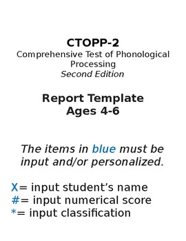
CTOPP-2 Report Template (Ages 4-6)
CTOPP-2Comprehensive Test of Phonological ProcessingSecond Edition Report TemplateAges 4-6This easy to use CTOPP-2 report template includes a description of the assessment, each of the sub tests to be administered for ages 4-6, an explanation of how each sub test relates to the composite scores, and a chart that identifies the classification for each standard score range. It is completely editable with a very simple "plug-in" format (symbols and words in blue indicate where editing is needed).
Subjects:
Grades:
PreK - 2nd
Types:
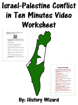
Israel-Palestine Conflict in Ten Minutes Video Worksheet
This video worksheet allows students learn about the origins and the continued conflict between Israel and Palestine. The video clip is only ten minutes long, but it is packed full of information that will keep your students engaged.This video worksheet works great as a “Do Now Activity” or as a complement to any lecture or lesson plan on current events, terrorism, or the Middle East. The worksheet helps students understand the current conflict in the Middle East. The video is great for visual l
Grades:
7th - 12th
Types:
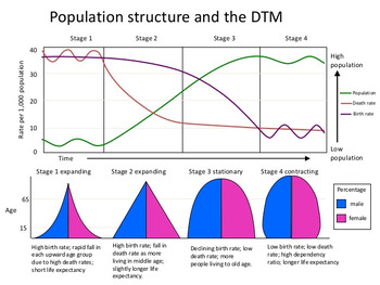
Demographic Transition Model (DTM) Lesson
This product will teach students the basics of how to read, understand and analyze the Demographic Transition Model or DTM. The product has a student note piece along with an activity/worksheet that can be used as an individual assignment or as a cooperative group activity. After students learn how to read the Demographic Transition Model they will answer questions to show their understanding of DTM and how population pyramids work with the DTM.This activity is great tool to introduce or review
Subjects:
Grades:
6th - 12th
Types:
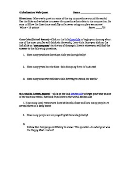
Globalization Webquest IKEA, COKE, WALMART, MCDONALDS Geography Culture Webquest
Globalization Webquest IKEA, COKE, WALMART, MCDONALDS Geography Culture Webquest ActivityNeed a computer with internet access.Explore the globalization of four companies with this webquest.
Grades:
6th - 10th
Types:
Showing 1-24 of 19,459 results

