302 results
Free geography bulletin board ideas
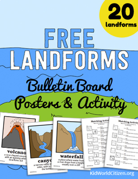
Free Landforms Bulletin Board Posters and Matching Activity
20 landform posters with illustrations and definitions, plus two matching activities! The landform vocabulary cards look stunning on a bulletin board, or they can be displayed digitally on the overhead projector to introduce your landforms unit. Teachers appreciate our design and clarity, and students love the illustrations.
Check out our full Landforms Unit!
Our Landforms Unit features an amazing Landform Flipbook, a Landform Minibook, A Landforms Memory Game, a Water or Land Activity, and an
Grades:
3rd - 5th
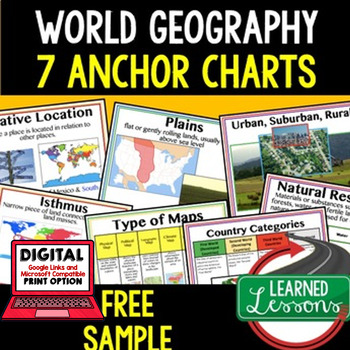
Geography Anchor Charts Sampler Free, World Geography Posters
Geography Free Anchor Charts (Great as Bellringers, Word Walls, and Concept Boards)(Great as Bellringers, Word Walls, and Concept Boards), Mapping Skills Posters, Geography Review Pages, Digital Activity via Google Classroom This bundle will take your through the entire Geography curriculum. It will include all components of Geography. This is perfect for traveling around the world in style. Sign up for email updates and follow me on TPT for updates.Anchor charts are great for representing
Grades:
6th - 12th
Types:
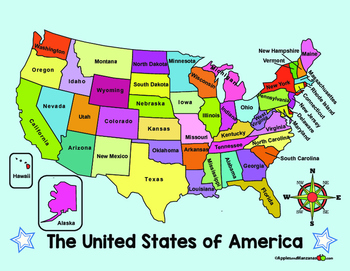
MAP of the US and COMPASS ROSE (in English)
ENGLISH VERSION of two full color maps of the US. One map lists the names of the states, the other map is left blank.
ALSO...One large compass rose and three smaller ones for display and projects.
Want it in SPANISH? Check out the free Spanish version in my store!
Subjects:
Grades:
PreK - 6th

Landform Dinosaur Review in English or Spanish
Use this as a review or to assess landforms. The dinosaur drawing gives a fun spin on a dry topic.
Included is a dinosaur page that students will label by referring to the list. The dinosaur and lists are provided in English and Spanish.
This was inspired by a Pinterest find and is not my original idea, it is free to all and designed to help you better take advantage of the super idea!
Subjects:
Grades:
K - 3rd
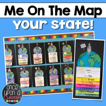
Me on the Map - Master Index
This is a master list of all the currently available "Me on the Map" state-specific and province-specific packs. Please note that you must click on one of the links below to bring you to the specific resources. Clicking on the "download" button on this listing does not give you the product. Some have referred to this as an advertisement for my other resources. However, my intent was to make it easy for you to quickly find the one you need. Elevate your Local Community or Global Community units
Subjects:
Grades:
K - 3rd
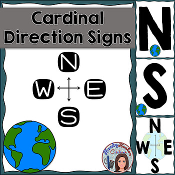
Cardinal Directions Geography Signs Blue
Hang cardinal direction and compass rose signs in your classroom to visually help your students with mapping concepts.
Product includes:
• North
• South
• East
• West
• Compass Rose with North, South, East, and West
• Compass Rose with N, S, E, and W
You might also be interested in:
The United States and Capitals Geography Review Activities and Assessment BundleThe United States and Capitals Geography Northeast Region Freebie SampleThe United States and Capitals Geography Review Activities
Subjects:
Grades:
K - 12th
Types:
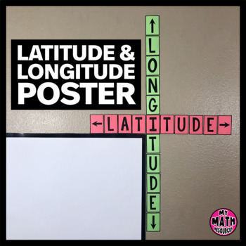
FREE Latitude & Longitude Poster - Classroom Decor
These simple latitude and longitude posters are a cute addition to ANY classroom! Wrap them around the corner of your whiteboard or bulletin board and they hardly take up any space at all.These posters will help your students remember the difference between latitude and longitude. And they are free!This is a black & white DIY poster. Print the pieces you want to use, cut them out, and assemble your poster. If you want your poster to look like mine, you'll need to print it on Astrobrights
Subjects:
Grades:
Not Grade Specific
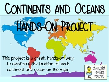
Continents and Oceans ~ Hands-On Project Idea ~ FREE!
This is a fun, hands-on project that will help your students learn the locations of the continents and oceans of the world on a map. Directions and pictures are included!
Subjects:
Grades:
4th - 6th
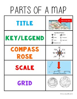
Parts of a Map Anchor Chart
Hang in your classroom or glue into student notebooks for a quick visual reminder of the parts of a map.
Subjects:
Grades:
Not Grade Specific
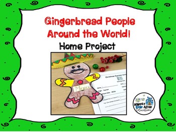
Gingerbread People Around the World! Home Project
Are you teaching a Christmas Around the World unit in your classroom? If the answer is yes, this is the perfect addition! This home project asks your students to choose a country and decorate their gingerbread person accordingly!It includes:* parent letter w/ suggested web resources* gingerbread man printable template* SUPER CUTE boarding pass sheet for creative response!* Bulletin Board IdeaTHIS IS PART OF MY CHRISTMAS AROUND THE WORLD UNIT! Click below to check it out!Christmas Around the Worl
Grades:
1st - 2nd
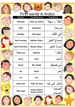
First words and numbers in Arabic ~ Great classroom posters
A selection of basic words and phrases to help you make children with a Arabic speaking heritage feel welcome in your class, or to help support topic work on different Middle Eastern countries.
If you find these useful please leave a review ~ thanks! For other free assessment, language and Islamic resources please check my website, www.the-treasure-box.co.uk
Note: This poster is now in full colour following many requests and the spelling mistakes have been corrected ~ a huge thank you to TES
Subjects:
Grades:
3rd - 12th, Staff
Types:
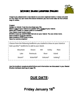
Mystery Island Project Instructions - Landforms
Imagine you discovered a new island no one ever explored before. It does not exist on any map! You can name this island whatever you want and make its first official map or model.
Use These set of Instructions for a Project Assignment with your LANDFORM Unit. I used this for my second grade class. It requires them to create an island that they discovered. They must name it according to its shape. They can get very creative with this. I have made an example of a final project: "Shark Island" in
Subjects:
Grades:
K - 5th
Island of the Blue Dolphins Map Project
The descriptive language of Scott O'Dell helps students to visualize the setting in Island of the Blue Dolphins. Created by Tried and True Teaching Tools, students take notes on geographic land features while reading the novel, then sketch out a map of the island using their notes. This is a GREAT way to teach writing with detail and description, story setting, as well as involve those visual students!
********************************************************************************
Customer Tip
Subjects:
Grades:
4th - 6th
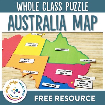
Australia Map Puzzle
Familiarise your students with the States and Territories of Australia with this Australia Map Puzzle. Have them not only sort the States and Territories into their correct locations, but also have students name them and the location of their matching capital cities.This map can be printed on A4 paper to be used in small group work, or if printed onto A3 paper, it can be used as a whole class exercise. Laminate for longevity.If you liked the look of this resource, you may also like:- States and
Subjects:
Grades:
3rd - 5th
Also included in: Australian Curriculum 8.4 Year 3 HASS Unit - Australia
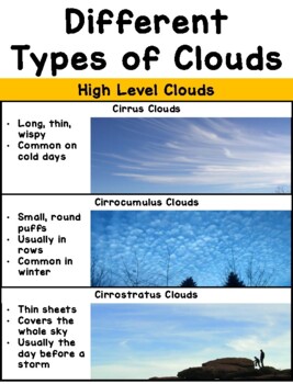
Types of Clouds Poster
Printable poster perfect for aspiring meteorologists! Print, assemble, and post on near your windows to help students identify (and characterize) the different types of clouds in our sky. I'd recommend printing it out on card stock paper with laminating for extra durability! The full size poster measures about 30" in length, but it can be made smaller by adjusting the printing size on your printer options. Works well as a personal cloud chart when printed 2 pages per sheet, then assembled in the
Subjects:
Grades:
PreK - 8th
Types:
NGSS:
K-ESS2-1
, 3-ESS2-1
, K-ESS3-2
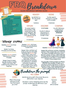
AP Human Geography - FRQ Quick Writing Guide
Use this one-page handout to remind your students of College Board's expectations for writing free response questions. Use this handout digitally or print it for students to use while they write their FRQs for AP Human Geography class!
Grades:
9th - 12th, Staff
Living and Working in Ontario Craftivity
Living and Working in OntarioGrade 3 Social Studies for the New Ontario Curriculum! This craftivity will give teachers a snapshot of what their students already know about the province. Also, it makes a great bulletin board for Student-led conference night! NOW AVAILABLE! My Living and Working in Ontario unit packet!! Partner talk cards, student worksheets, more craftivities, research project resources and an application task are available in my store!Thanks for stopping by! -Tina
Subjects:
Grades:
3rd
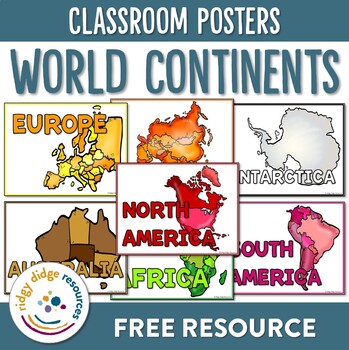
Continents of the World Classroom Posters
Familiarise your students with the continents around the world using these brightly coloured classroom posters. Including posters for each of the 7 continents as well as letters to form the word continents, they are bound to support your students as they explore these diverse continents!If you liked the look of this resource, you may also like:- Continents of the World Lapbook Templates- Australian Geography and Landmarks Worksheets- Australian Landmarks PostersFAQCan I share this resource with
Subjects:
Grades:
1st - 3rd
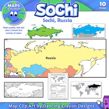
Maps of Sochi / Russia: Clip Art Map Set
Free clip art maps of Sochi and Russia.
Map Collection: Sochi, Russia
Do your students know where Sochi is?
With the 2014 Winter Olympics soon to begin, here’s an opportunity to teach your students more about the city of Sochi and its location in Russia. The set includes a bonus student worksheet.
This clipart map set contains the following commercial use graphics:
- Color maps of Russia showing the location of Sochi
- Black and white line art maps of Russia
- Map of the world with Russia
Grades:
3rd - 12th
Maps Word Cards Freebie
Looking for All About Maps word cards? Here's a freebie that includes the following words: map, symbol, line symbol, point symbol, area symbol, map key, compass rose, cartographer, bird's eye view, street, city, country, continent, and planet.
This resource is part of a comprehensive resource on maps. Click here to purchase and download. It includes posters, word cards, nonfiction unit booklet, lap book guide, mapping activities, workbook, answer key, graphic organizers, and writing activities.
Subjects:
Grades:
K - 1st
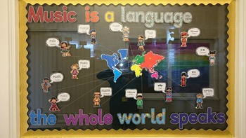
'Music Is A Language The Whole World Speaks' display
Thnaks to Braun Ream, a fellow member of the Music Teachers Facebook group for this idea, and for creating the speech bubbles in different languages.A ready-to-make display perfect for music classroom everywhere. Included are the letters for the title, the world map, speech bubbles with text ('music' in different languages with the name of the language underneath) and clipart children wearing clothes related to their country.Children and speech bubbles included in the following language:FrenchHi
Subjects:
Grades:
Not Grade Specific
Types:
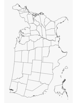
3 blank maps, printable maps of U.S.A. and North America
Blank map poster of the U.S.A. and 50 statesMap of North America with major citiesBlank map poster of 13 colonies for proclamation of 1763 Print and Laminate Maps for reusable map work in your social studies classroom
Grades:
5th - 12th
FREEBIE- Physical and Political Regions of Canada Intro
This freebie includes two activities to get your kiddos started with the Grade 4 Ontario Social Studies unit- Physical and Political Regions of Canada
The first activity is a flap book where students are able to share their knowledge of Canada with some diagnostic questions. With some colouring and a maple leaf, it makes it a fun and engaging way to start your unit! Plus- it makes for a great display!!
The second activity are discussion cards. You can use these cards for partner talks or whole
Subjects:
Grades:
4th
Types:
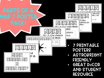
Free! Parts of a Map Posters
These posters are a great resource for any grade level when learning about maps. These maps use the acronym "TODALS" as a quick way to remember the parts of a map: Title, Orientation, Date, Author, Legend, and Scale. These posters are AstroBright friendly and really brighten up a room!
Grades:
K - 12th
Showing 1-24 of 302 results


