270,000+ results
World history resources for products for TpT sellers under $5
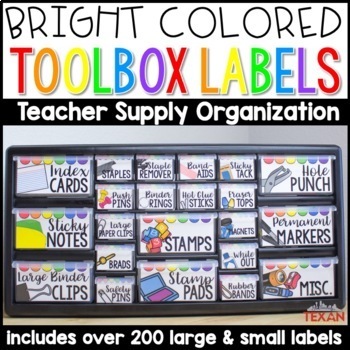
Bright Teacher Toolbox Labels (Editable Template Included)
Make organizing your teacher materials fun and easy to access! These labels includes 106 of both large and small school supply labels that fit perfectly into your teacher toolbox. Quick and easy setup plus bright, easy to read text makes grabbing your supplies simple throughout the school year. These toolbox labels include everything you’d need to set up and use your teacher toolbox in your classroom. You can also edit the labels to fit your needs if you have something that is not on your list.
Subjects:
Grades:
Not Grade Specific
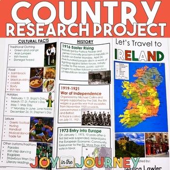
Country Research Project (Print & Digital)
Send your students on a world-wide tour with this print-and-go Country Research Travel Brochure Project! This fun and engaging project includes everything you need to assign the travel brochure, stay organized, guide the students in their research, and assess the final projectDownload includes:Brochure Sample Country Research Project Instructions“My Country Choices” – 4 per page (give one to each student)Student Country Choices Tracking SheetTravel Brochure Layout DirectionsResearch Log Student
Grades:
4th - 6th
Types:
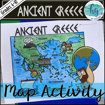
Ancient Greece Geography Map Activity (Print and Digital Resource)
This activity will help students better understand the geography of Greece and its impact on Ancient Greek civilizations. They will label and color the blank map version and then answer a few questions. Alternatively, students can just color on the coloring page version. It's a great way to incorporate geography in your lesson.What's included with the Printed Versions:*Ancient Greece map for students to label, color, and answer 10 questions (1 page map, 1 page directions/questions, uneditable pd
Grades:
6th - 10th
Types:
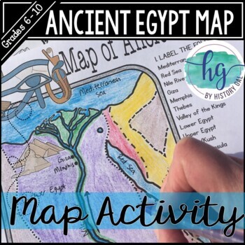
Ancient Egypt Map Activity (Print and Digital Resource)
Students will learn about important places in the Ancient Egypt civilization as they label and color a map. It's also a great way to incorporate geography in your lesson.What's included with the printed version:Blank Ancient Egypt map for students to label and color (1 page, uneditable pdf)Map Key (1 page, uneditable pdf)Ancient Egypt map for students to just color (1 page, uneditable pdf)Informational Reading (1 page, uneditable pdf) Animated PowerPoint shows each location and the key - perfect
Subjects:
Grades:
6th - 10th
Types:
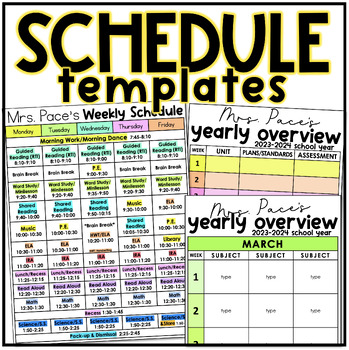
Schedule Templates • Daily Schedules • Weekly Schedules • Yearly Overview
Simple, colorful, editable, and easy-to-use schedule + planning/scope-and-sequence templates for many different uses! Available in PowerPoint AND Google Slides!Templates available both in color and black/white for:daily schedulesweekly schedulesyearly schedules (scope & sequence)Each schedule mentioned above comes in a variety of formats. Pick the formatting that works best for you! All tables included can be edited. (I have included an editing table how-to in the resource.) Tables come in a
Grades:
PreK - 6th
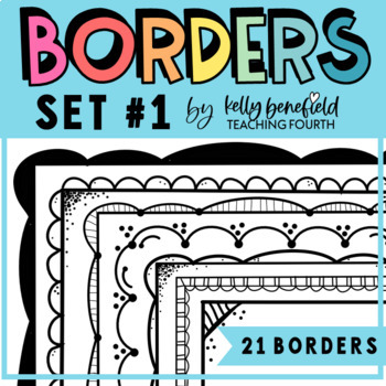
Doodle Borders Frames Clipart Commercial Use Set 1 Black and White Page Borders
This creative set of 21 borders will make your TpT products and classroom creations stand out! Use on worksheets, handouts, task cards, activities, games, and much, much more!For Personal and Commercial Use ClipartThis best-selling packet of borders is filled with 21 fun borders that are perfect for your teaching resources and creations! Each one comes with a transparent background as well as a white background for a TOTAL OF 42 BORDERS.All of these borders are in png format so they can easily b
Grades:
Not Grade Specific
Also included in: Kelly Benefield Borders My Entire Store Bundle Clipart for TPT Sellers
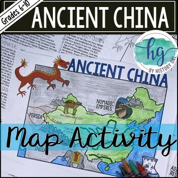
Ancient China Map Activity Lesson (Print and Digital Resource)
This activity will help students better understand the geography of Ancient China. They will label and color the blank map version and answer a few questions. Alternatively, students can just color on the coloring page version. It's a great way to incorporate geography in your lesson.What's included with the printed versions:*Blank Ancient China map for students to label, color, and answer questions (1 page map, 1 page directions, uneditable pdf)*Blank Ancient China map for students to label, co
Grades:
6th - 10th
Types:
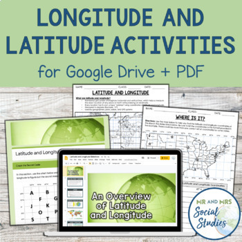
Latitude and Longitude Fun Activities and Practice Worksheet | Google Slideshow
If you are looking for a creative and no-prep resource to teach about latitude and longitude, look no further! This printable and digital activity includes an editable Google Slideshow to teach your students about latitude and longitude, and three different practice activities, giving your students the chance to decode secret messages, figure out mystery locations on a world map, and determine the coordinates of various US states.This resource goes beyond traditional longitude and latitude works
Grades:
5th - 8th
Types:
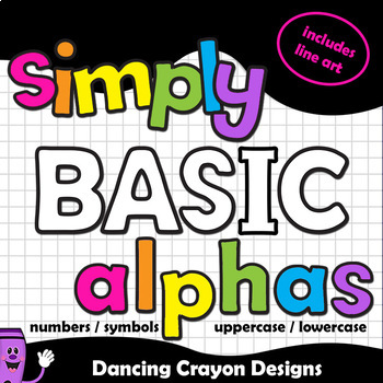
Alphabet Letters Clip Art | Bulletin Board Letters and Numbers
Alphabet Clip Art Letters and Numbers | Classroom Décor SetPerfectly practical! This is a set of simple-styled letters in a range of bright colors. Includes a full set in 7 bright colors (perfect for cover pages) and one full set in black and white line art (perfect for printables). Create your own classroom decor and bulletin board lettering or make your product covers POP.The bright colors will make your titles jump off the page. Contains upper case, lower case, numbers, and some symbols.
Grades:
PreK - 12th, Higher Education, Adult Education, Staff
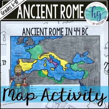
Ancient Rome to 44 BCE Map Activity (Print and Digital)
Students will label and color a map of Ancient Rome in 44 BC/BCE to better understand the expansion of Roman power. Students will also answer 6 questions about the map. What's Included with the print versions:*Blank map with 6 questions for students to answer (2 pages, BC and BCE versions included, uneditable pdf)*Blank map without questions (1 1/2 pages, BC and BCE versions included, uneditable pdf)*Map for students to just color (1 page, BC and BCE versions included, uneditable pdf)*Answer key
Subjects:
Grades:
6th - 9th
Types:
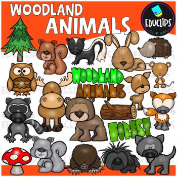
Woodland/Forest Animals Clip Art Set {Educlips Clipart}
This is a set of woodland animals. The animals included in this set are: bear, deer, fox, hedgehog, mole, owl, porcupine, rabbit, red squirrel, skunk, grey squirrel, mouse, wolf, moose. Also included are trees, toadstool, log and word art sign.41 images (21 in color and 20 in B&W)This set contains all of and only the images shown.Images saved at 300dpi in PNG files.For personal or commercial use.CLICK HERE for TERMS OF USEThis is a zip file. Before purchasing, please check that you are able
Grades:
PreK - 5th, Staff
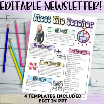
Meet the Teacher Newsletter Template- EDITABLE Back To School
Are you looking for a cute newsletter you can hand out during open house or on the first day of school for your students and parents to get to know you? This editable Meet the Teacher Newsletter is what you need! This newsletter is editable so you can customize it to meet your needs when introducing yourself!✨✨Buy this newsletter with a different title or theme! ✨✨Included in this product:-4 Newsletter templates with editable text boxes-Editable headings to text boxes-Font names used in previews
Grades:
Not Grade Specific
Also included in: Groovy Retro Classroom Decor GROWING Bundle
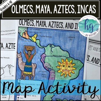
Mesoamerica (Olmecs, Maya, Aztecs) and Incas Map Activity - print & digital
Students will label and color a map to help them visualize and retain the location of the Olmecs, Maya, Aztecs, and Incas in Mesoamerica and South America. They will also label bodies of water and mountain ranges as well as use the map to answer 5 questions. What's Included with the Printed Map:*Blank map with 5 questions for students to answer (2 pages, uneditable pdf)*Blank map without questions (1 1/2 pages, uneditable pdf)*Map for students to just color (1 page, uneditable pdf)*Answer key fo
Subjects:
Grades:
6th - 9th
Types:
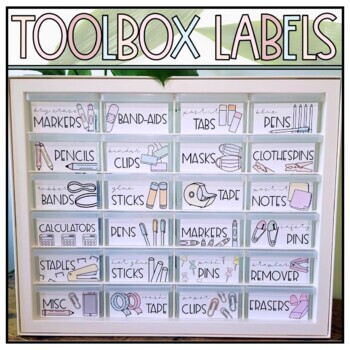
Teacher Toolbox Labels - Neutral Pastel Supply Labels - IRIS & Akro-Mils Toolbox
Organize your supplies, or spruce up your classroom and office with these pastel teacher toolbox labels! These minimalistic, neutral toned supply labels feature a wide range of school supplies and personal items, enabling you to customize your teacher toolbox. They are designed to fit on your IRIS and/or Akro-Mils Drawers (see specific models below), but can also be used to label bins or other miscellaneous items. The teacher toolbox labels created will fit in the IRIS and Akro-Mils toolboxes li
Grades:
Not Grade Specific
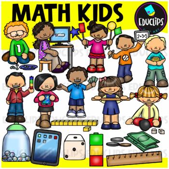
Math Kids Clip Art Set (Educlips Clipart)
A set of children engaged in math activities and using math manipulatives including ipads, computer, ruler, base ten blocks, unifix, money, dice, shapes and marbles. Separate manipulatives are also included: ipads, ruler, dice, marbles, money & unifix cubes.*PLEASE NOTE: these are hand drawn images and therefore, measurement tools are not accurate. This set has been updated and replaces a previous set of math kids.34 images (17 in color and the same 17 in B&W)This set contains all of the
Subjects:
Grades:
PreK - 5th, Staff
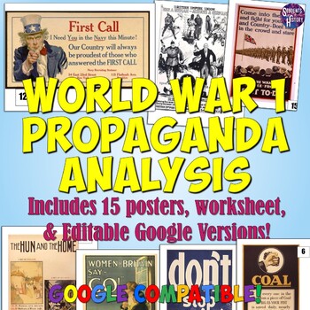
World War 1 Propaganda Analysis Activity
This lesson on WW1 Propaganda has students utilizing higher-level thinking skills to analyze 15 primary source propaganda posters. Everything you need is included for the lesson plan, including a worksheet, 15 full color propaganda posters, and an answer key.The worksheet explains the 5 main objectives of wartime propaganda and has students come up with their own personal definition of propaganda. They then determine the goal of each poster based on the objectives. This provides a framework for
Grades:
7th - 12th
Types:
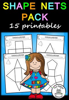
Shape Nets (3D) - 15 printable net templates (Maths - Geometry)
This pack is part of our larger 3D shape pack which includes over 50 3D shape worksheets..
This pack includes 15 printable 3D shape net templates:
Triangular prism
Rectangular prism
Cube
Square based pyramid
Cuboid
Rectangular based pyramid
Pentagonal prism
Pentagonal pyramid
Hexagonal prism
Hexagonal pyramid
Octagonal prism
Octagonal pyramid
Cone
Cylinder
Parallelepiped
If you like this pack, take a look at our 2D & 3D Shape Packs and Shape Posters Pack:
2D Shape Pack
3D Shape Pack
Shape
Subjects:
Grades:
K - 6th
Also included in: Shape MEGA Bundle – 130+ printables
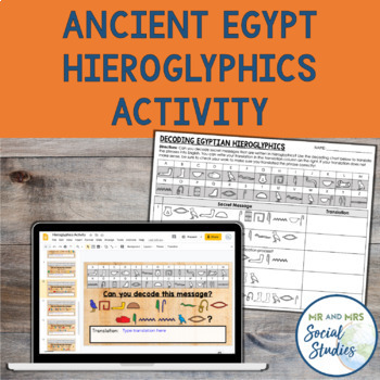
Ancient Egypt Hieroglyphics Decoding Activity | Digital and Printable Worksheets
Teach your students about hieroglyphics in this engaging, digital and printable Hieroglyphics Activity! In this no-prep activity, students will decode 10 secret phrases and translate them to English. There are also a few slides of background information about hieroglyphics and the Rosetta Stone, in addition to an optional enrichment activity where students create their own secret messages.This Ancient Egypt Hieroglyphics Activity includes:Teacher GuideGoogle Slideshow with Editable Text (ready t
Grades:
5th - 8th
Types:
Also included in: Ancient Egypt Unit Bundle | Activities, Projects, Notes, Timeline, Test
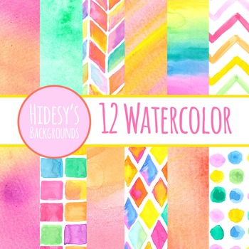
Watercolor Digital Papers, Bright Watercolour Backgrounds Clip Art
12 Hand Painted Watercolour Paint Papers or Digital Backgrounds or Textures or Patterns.See more Watercolor clip art - click hereSee more Digital Papers - click hereDigital backgrounds are great for digital and print use including powerpoint, scrapbooking, invitations, worksheets, cards, etc.All files are 10 inch by 10 inch squares, at 300dpi. Backgrounds are licensed for personal use or commercial use in any educational product. Credit is appreciated but not required. All backgrounds are cop
Subjects:
Grades:
Not Grade Specific
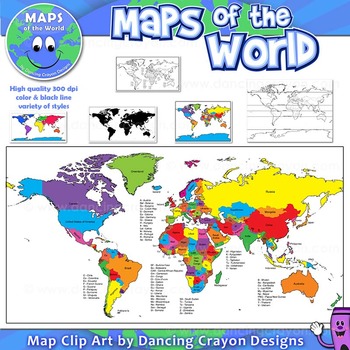
Maps of the World: Clip Art World Maps
Maps of the World: Clip Art World Maps
High quality color and black and white maps of the world.
This clipart map set contains the following commercial use graphics:
- Color maps of the world
- Black and white line art maps of the world
- Maps of the world with lines of latitude and without lines of latitude
- Maps of the world with larger countries labelled (color and black and white)
- Silhouette maps of the world
- A map of the world showing seven continents in color and black and white:
Grades:
3rd - 12th, Higher Education, Adult Education, Staff
Also included in: Maps of the World Clip Art - MEGA-BUNDLE
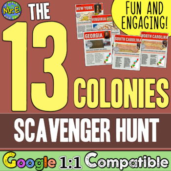
13 Colonies Map and Scavenger Hunt Activity
In this 13 Colonies activity and map scavenger hunt, students complete a gallery walk on the colonization of the 13 American Colonies. Students navigate around the room examining each colony's station to understand the reason behind its founding. Students can work individually or they can create groups and, before they are turned loose, divide up the responsibilities to research the founding of the 13 Colonies and detail the 13 Colonies map. This lesson is a great introduction to the 13 colo
Subjects:
Grades:
5th - 8th
Types:
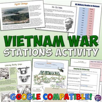
Vietnam War Station Activity for the Cold War
This engaging lesson for the Vietnam War has students rotate through stations to learn about various aspects of America's War in Vietnam. The 7 different stations cover:The Cu Chi TunnelsVietcong Booby TrapsAgent OrangeHo Chi MinhSongs of the Vietnam WarThe Draft and ProtestsMilitary Deaths in the WarEach station engages different intelligences and learning styles. Students create a graph, listen to music, draw pictures, read, answer questions,and analyze pictures. My students are always engaged
Grades:
5th - 10th
Types:
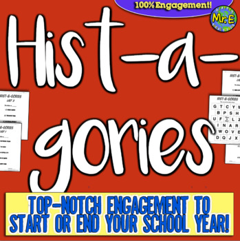
Histagories Trivia for Social Studies, US, and World History Activity
In this history review and conversation game, students are engaged with 8 short lists of information where they work with partners (or individually) to try to come up with answers based on the letter for the round. Included is a letter-choosing paper (students flip a coin and see where it lands!) plus 8 different lists geared toward History, Geography, Geology, and Social Studies themes! A condensed worksheet is also included to save space.Enjoy this fun way to spend the first few (or last few
Subjects:
Grades:
5th - 8th
Types:
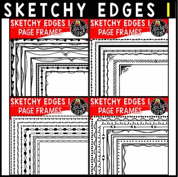
Sketchy Edges 1 - Hand Drawn Page Border Clip Art Bundle {Educlips Clipart}
This is a collection of hand drawn, sketchy page frames. The frames are 8.5"x11" and should fit automatically onto the page when used in a program such as PowerPoint or similar programs. Frames can be adjusted and resized to fit snugly against the edge of the page.Each frame has 2 options: a white filled center and transparent center. 32 black frame designs Total of 64 images (32 transparent fills & 32 B&W fills)This set contains all of the images shown.Images saved at 300dpi in PNG fil
Grades:
Not Grade Specific
Showing 1-24 of 270,000+ results

