13 results
Geography Common Core RST.6-8.3 resources
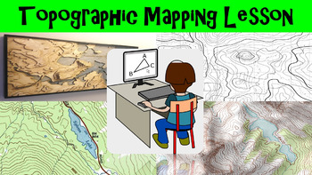
Topographic Mapping Lesson with Worksheet, Power Point, and Map Reading Activity
This lesson goes over how topographical maps are constructed, what their symbols mean, and what we use these maps for. The worksheet follows along with the power point presentation to keep students engaged. The map reading activity gives a students a simple topographic map that they have to answer questions by interpreting the map. This lesson is designed for late elementary through intermediate grades.
Key Terms Include:
- topography
- contour lines
- contour intervals
- index contours
- scal
Subjects:
Grades:
4th - 8th
Types:
Layers of the Atmosphere Build an 8-foot Scaled-Down Model of our Atmosphere
Create an 8-foot-tall (2.4m), scaled-down model of our atmosphere and discover cool information about our atmosphere at the same time! Students will also learn a little history about humankind's ventures into our atmosphere.Includes Troposphere, Tropopause, Stratosphere, Stratopause, Mesosphere, Mesopause, Thermosphere, and Exosphere. No prep.The only way to get a true sense of atmospheric scale is with a model this big!Crosscutting concepts: scale, proportion, & quantity, systems & sy
Subjects:
Grades:
6th - 12th, Adult Education
Types:
CCSS:
Also included in: Ecology, Environmental Studies, and Earth Science Activities Bundle
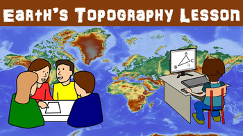
Earth's Topography No Prep Lesson with Power Point, Worksheet and Vocabulary
This lesson goes over the different types of topography that are found around the globe. It includes explaining the different types of land forms such as mountains, plains, and plateaus. The worksheet follows along with the power point presentation to keep students engaged. This lesson is designed for late elementary through intermediate grades.
Key Terms Include:
- topography
- elevation
- relief
- land forms
- plains
- coastal plains
- interior plains
- mountains
- plateaus
- land form regio
Subjects:
Grades:
4th - 8th
Types:
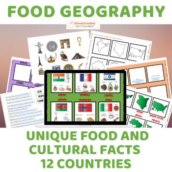
Food Culture and Cultural Geography - Sorting Mats & Activities!
Explore the rich tapestry of global food culture and cultural geography with "Food Culture and Cultural Geography," a captivating unit study designed to foster hands-on learning and deepen students' understanding of diverse cultures around the world. Perfect for diverse learners, this comprehensive resource offers a variety of activities tailored to accommodate different learning styles and abilities.Key Features:Sorting mats provide hands-on learning opportunities for students of all ages and a
Grades:
PreK - 12th
Also included in: Wings of Fire Book 1 Novel Study and Food Geography Bundle
Monitoring Earthquakes No Prep Lesson with Power Point, Worksheet, and Activity
This lesson goes over the different types of equipment used to measure the strength of earthquakes. Some equipment we use today has origins that can be traced back 2000 years ago to ancient China. The activity gives students a chance to interpret seismograms to compare earthquakes. The worksheet follows along with the power point presentation to keep students engaged. This lesson is designed for late elementary through intermediate grades.
Key Terms Include:
- seismograph
- seismogram
- tiltme
Subjects:
Grades:
4th - 8th
Types:
Platypus PowerPoint with Activity and Study Guide
Get ready to explore the world of the Duck-billed platypus, one of the most bizarre and mysterious mammals in the world from eastern Australia and Tasmania. Platypus facts include that they sport a tail like a beaver, bill and feet like a duck, and lay eggs like a bird! Platypuses give birth to furless babies called puggles. What's Included:One Quick Start GuideOne 23-slide animated PowerPoint (both PPTX and PDF file types)One 20-page fillable student activity and study guideOne 26-page EDITABLE
Subjects:
Grades:
3rd - 8th
NGSS:
4-LS1-1
, MS-LS1-4
, 4-LS1-2
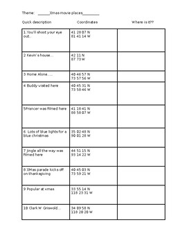
Google Earth Christmas Scavenger Hunt
Fun activity using google earthRequires internet and google earth accessHave kids explore these locations from famous Christmas moviesFun activity - should take around 30 minutesBest if students work in pairs with someone who is familiar with Christmas movies and if the street view is working Fun to do in pairs with one partner being a fan of Xmas movies **Street view doesn't work in all locations especially #8- but hopefully kids can use deductive reasoning for a few of them** As an extension a
Grades:
7th - 12th
CCSS:
NGSS:
HS-ESS2-1
Earth/Space Lesson I PowerPoint "What is Climate?"
This lesson aligns with the Common Core State Standards (CCSS):"STANDARD 7 - The EarthThe teacher understands the dynamic nature of the Earth and recognizes that its features and structures result from natural processes.Knowledge Indicators - The competent science teacher:7A. understands the structure and composition of the Earth's land, water and atmospheric systems.7B. understands the transfer of energy within and among Earth's land, water and atmospheric systems."First lesson in the Earth/Spa
Subjects:
Grades:
6th - 10th
CCSS:
NGSS:
MS-ESS2-4
, MS-ESS2-6
, MS-ESS2-5
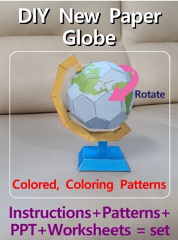
DIY 3D New Paper Globe, Earth Globe, Science Activity, Plate Boundaries, Polygon
[ Paper Globe ] Hands-on activities, paper craft challenges[TOOLS]- Scissors- Cutter- Glue(wood glue or craft glue)- Mechanical pencil(no-lead) : scoring tool- A4 size paper(200~220g)--------------------------------------------------[INCLUDE]1. Globe Assemble instructions(PDF) 3pages2. Globe Pattern(PDF) 8pages - Coloring Pattern 4pages - Colored Pattern 4pages3. Globe hands on activity worksheets 5pages4. Globe hands on activity PPT 18pages - Included Further Study : Coloring model, Plate
Subjects:
Grades:
6th - 10th
Types:
CCSS:
NGSS:
HS-ESS2-1
, MS-ESS2-2
, MS-ESS2-6
Earth Models No Prep Lesson with Power Point, Worksheet and Coordinates Activity
This lesson begins with going over how Greek scientists made the discovery that the Earth was a sphere. It was very challenging to accurately map the Earth so scientists today use a grid system. Scientists can also make map projections using different techniques, but each technique has its own drawback. The worksheet that is included goes along with the power point presentation to keep students engaged. This lesson is designed for late elementary through intermediate grades.
Key Terms Include
Subjects:
Grades:
4th - 8th
Types:
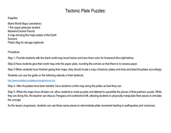
Tectonic Plate Puzzles
With this activity, students will use a simple paper plate and the attached world map to model and label the major tectonic plates on Earth. Students will cut their maps and make puzzles for their partners to put together. While they are assembling their puzzles, they can manipulate the pieces to simulate Pangaea and the concept of continental drift. Additionally, students can use the pieces to demonstrate the movements within the plates that cause earthquakes and volcanoes.
Subjects:
Grades:
4th - 6th
Types:
CCSS:
Earth/Space Lesson III PowerPoint "Climatic Changes"
This lesson aligns with the Common Core State Standards (CCSS):"STANDARD 7 - The EarthThe teacher understands the dynamic nature of the Earth and recognizes that its features and structures result from natural processes.Knowledge Indicators - The competent science teacher:7A. understands the structure and composition of the Earth's land, water and atmospheric systems.7B. understands the transfer of energy within and among Earth's land, water and atmospheric systems."Third PowerPoint lesson in th
Subjects:
Grades:
6th - 10th
CCSS:
NGSS:
MS-ESS2-4
, MS-ESS2-6
, MS-ESS2-5
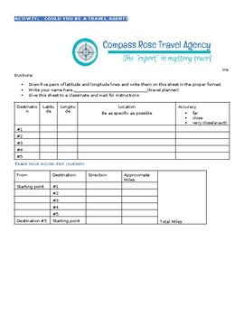
Travel Agent Geography Activity -Latitude/Longitude, Distance/Direction EDITABLE
My students love this fun activity that requires them to demonstrate knowledge of latitude/longitude, distance/direction and other map skills. It is great as a review or summative assessment.Essentially, each student takes on the role of a travel agent. I use the following procedure, but this format is easily adaptable to your needs.1) Each student draws 5 latitude coordinates and 5 longitude coordinates. (A file with coordinates is attached and ready for you to cut out.)2) Each student w
Subjects:
Grades:
4th - 8th
Types:
Showing 1-13 of 13 results


